| « Waterfalls at Catlins | Milford Sound » |
Day one
The boat arrived to starting point of the trek and the rain was even worse. It is only 6km to the Clinton Hut - the 1st accommodation. Whole footpath is flat and easy to walk.
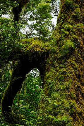
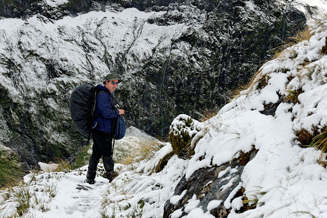
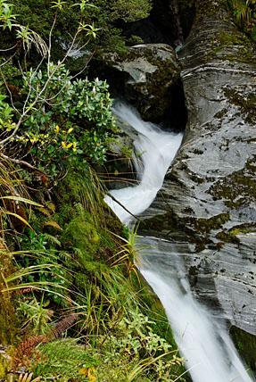
There is another thing that impressed me a lot. We got small yellow plastic bags for all rubbish we produce during these 4 days and we will take them out of National Park. The effect could be seen immediately - whole trail was clean. I did not take any photos during our walk, it was raining and I knew there will more opportunities to get my camera wet later. Forest around was typical rain forest - green, lush, wet, with big tree ferns, trees were covered by moss. When we arrived to hut I was completely wet. I guess the cheap raincoat from Go Outdoors was not so good deal in the end. All wet clothes were hanged outside of hut, some of them we could dry in kitchen, but the space was limited. Peter smartly selected bunks next to door in case we needed to leave in hurry before angry co-hikers started to look for snorers :-) He was partially right - 2 came to him next morning, asking who was snoring. They wanted names, to make sure they select different cabin next evening. Only after eating I went out to take a few photos around. They are not good, but they show how it looked like. With nice weather it would be amazing, all those mountains around, waterfalls falling everywhere, surrounded by strange vegetation. In the evening we had a briefing. Ranger Ross told us what we can expect tomorrow. Apart from description of track he mentioned also birds and other living creatures. However, I could not understand his accent easily so only thing I really understood was that everything looks like a duck :-) OK, I understood a few things - for example nobody is allowed to leave tomorrow before he makes sure whole trail is passable (and that will happen after 7am). He did not expect flooding, but you never know in this area...
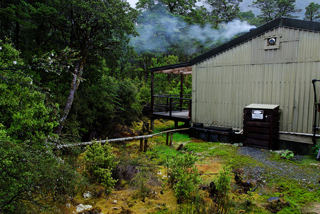
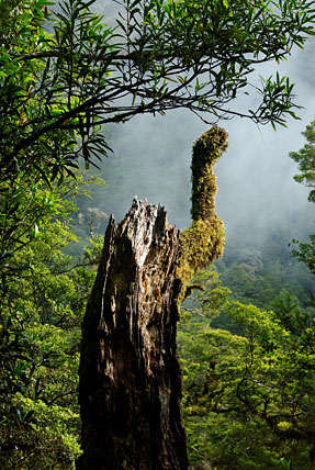
Backyard of kitchen.
Day two
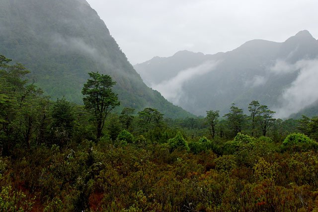
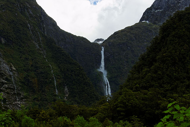
We continued along the river. It was raining slightly less, so I could pull out my camera. Clouds were quite low, hiding tops of surrounding hills, but providing nice misty photo opportunities together with foliage around.
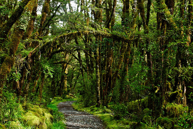
Nearly whole footpath was flat, only last part was uphill. It is about 14km, it is well marked - there is a pole every mile. The beginning of a day is in a forest, followed by nice scenery in a valley and finally you will get into forest again.
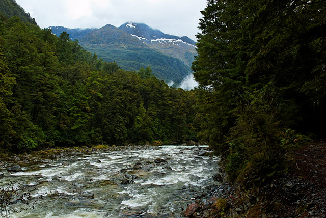
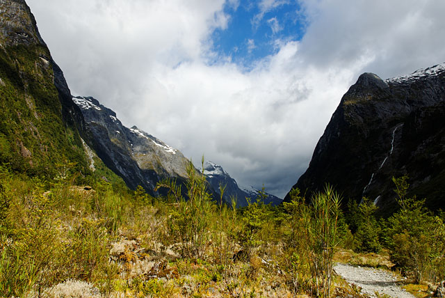
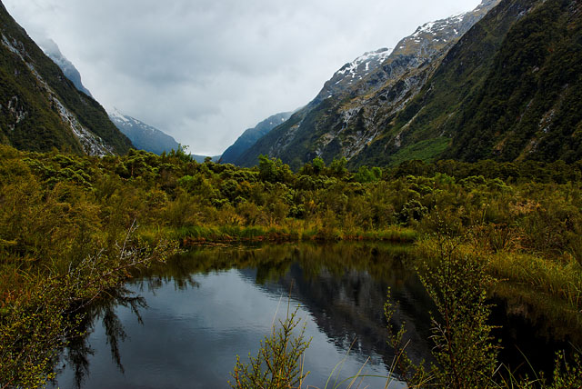
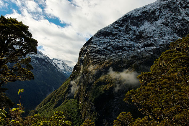
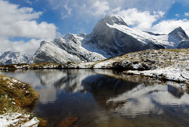
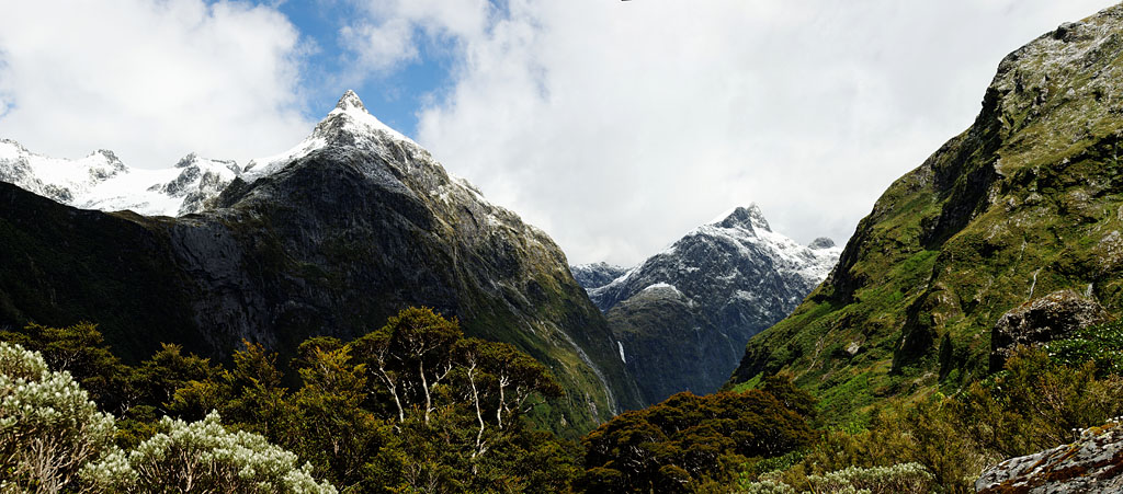
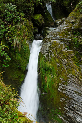
We reached a valley and immediately it started to look better. Visibility was better and rain stopped occasionally, but it never lasted for long time. I thought this is the highlight of our hike, because I doubted the weather could get better.
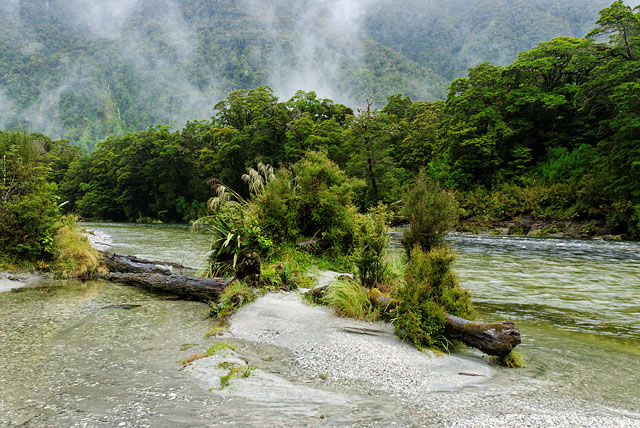
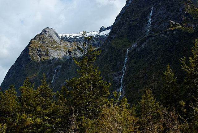
There is a photo in a big book about this hike in Visitor Centre (Te Anau) showing this place during flood. People are walking in water reaching their waists. That happens after long rain. That means raining we got was not bad at all, it was just pretty inconvenient. Somewhere here we should be able to see Mackinnon Pass - the highest point of this trek we will pass tomorrow. But I am not sure where exactly and whether we could see it due to mist. I guess the 3rd photo could show it in distance. We got closer to waterfalls at this place, some of them even got names (or their names were provided along the footpath).
We passed through bridge over Marlenes Creek. The creek was strong, but nothing compared to a photo of it we have seen later in Te Papa Museum in Wellington showing it going really wild.
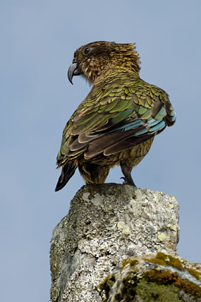
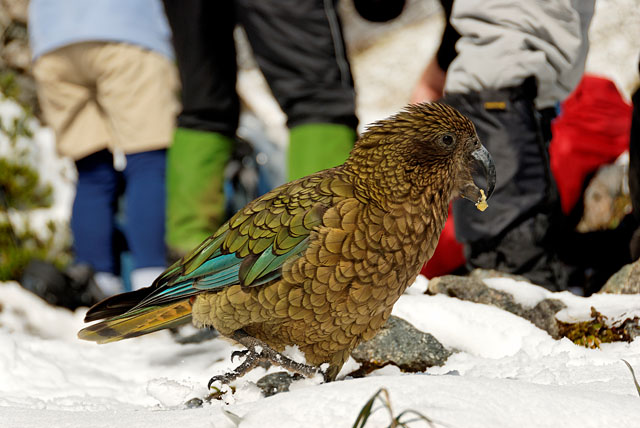
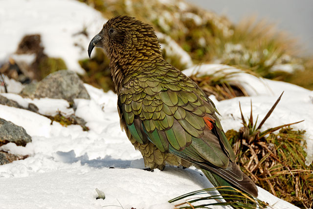
We are slowly approaching Mintaro Hut, looking forward for every mile pole, hoping to see it around "every corner". The forest is full of strange sounds, we learned later local alpine parrots - Kea - were responsible for them. Kea are fantastic. They are curious, not afraid of humans and they attempt to destroy everything man made they can test with their beaks. For us that meant we could not leave anything outside of hut unless it was hanging from a rope or a peg. Walking shoes left on veranda? Perfect object of their curiosity. It will turn into unrecognisable mess soon. When he arrived to the Mintaro Hut others navigated us immediately to a small room "that is snore room". A family with 2 children was already there... Those 2 children were only victims of our new snore band, because Zuzka used her ear plugs. To our disappointment this hut did not have any infrastructure for drying clothes. So everybody dumped their wet shoes and t-shirts around furnace hoping they will dry despite inefficient drying technique and competition of other 39 people.
Day three
During a briefing yesterday we learned it might be snowing today over altitude 700m. That's interesting. We had hailstorm yesterday evening, but it happens also in Europe in the summer. On the other hand it is usually not snowing in Europe at similar latitude and altitude 700m in the summer.
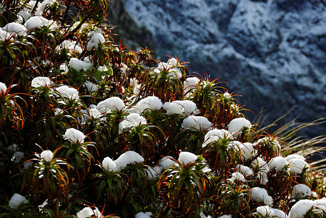
We did not hurry in the morning and left the hut among last people. We knew it will be the hardest day of our hike today - we will start with ascent for about 500m (no big deal), but then we will need to descend 970m (problems with knees for some). It was not snowing during day, but there was enough snow around when we got closer to Mackinnon pass. It was very nice change.
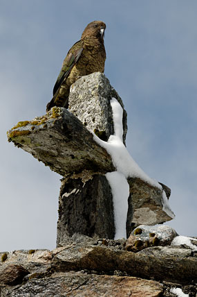
Kea hoping for some donations from hikers did not hesitate to wait in this snow covered, cold and windy place.
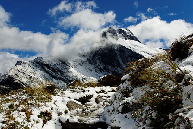
To our delight a mist surrounding us in Mackinnon Pass when we arrived was blown away by wind quickly.
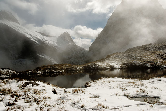
Leading to sights like this.
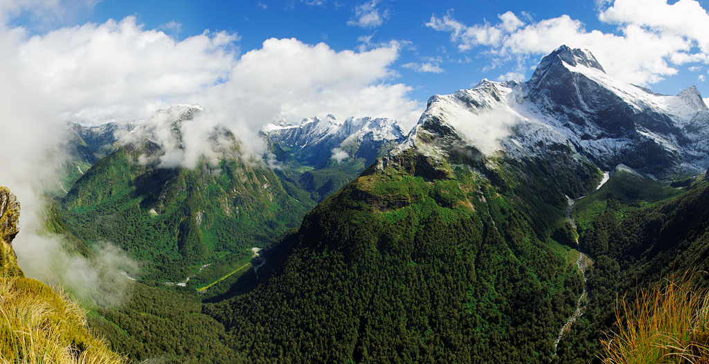
It was amazing up there! With sunshine and blue sky we finally could see why Milford Track is so popular. Mountains and nice green valleys between them look like Norway. Thanks to sun I could strip to t-shirt, allowing it to dry - welcomed change after 2 days of covering ourselves and our backpacks in raincoats.
We refilled our bottles at day shelter and continued down, still marvelling at beauty of this place. Regarding water during Milford Track - every hut collects rain water, that is OK to drink, but if you want you can boil it. Then there are 2 places when you can refill your bottles: here at Mackinnon Pass and then down at day shelter next to guided walks owned Quintin Hut. They provide hot water to independent walkers! The 1st, 2nd and 4th day you need to carry everything you are going to need with yourself. All food included.
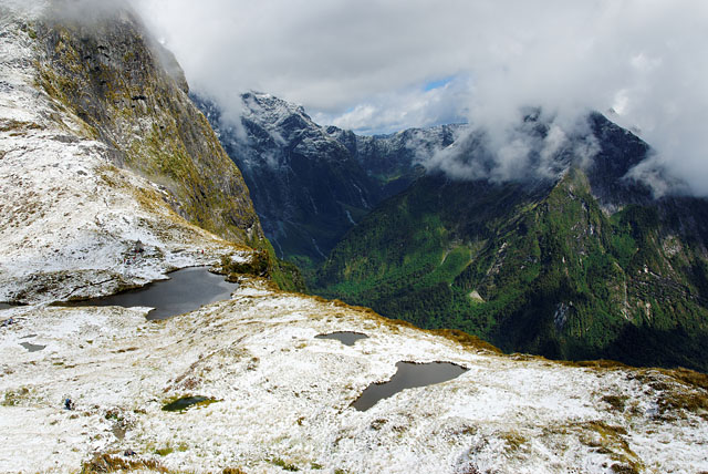
A vertical cliff next to the lake is amazing. We were told there was a barrier once, but it was removed for security reasons. People used to lean over or sit on it, but some of them got nasty surprise of 12 second fall. The cliff is nicely visible later, after descending from the pass.
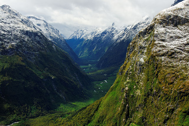
Our descent started nicely. We passed through non-stopping area where rocks fall in summer and avalanches at other times. There were many thin waterfalls, all way along nearly vertical cliff. We crossed a creek, getting to other side of the valley, and then we heard roar of falling rocks behind us in distance followed by short lived waterfalls.
Slowly the knees started to ask for slowing down and we did. That was fine, because we could immerse in beauty of this place more. Hikers from guided walks passed along us and many remaining people from our group.
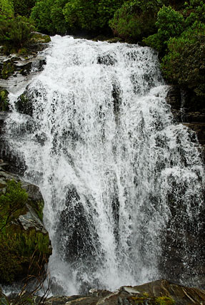
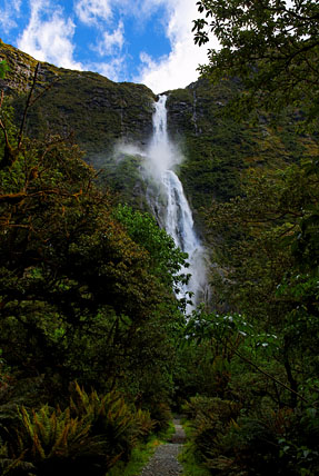
The top of Sutherland Falls is visible in distance. More photos will follow later.
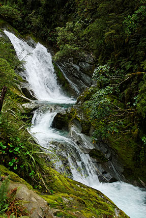
Small waterfalls and rapids in Roaring Burn. My battery ran out here so I switched to other only to learn it was nearly empty. I don't know what happened, it probably got discharged due to humidity and cold. Since this point I was in film shooter mindset: "think twice what you are going to take picture of". I cannot say I enjoyed it much, because I am rather trigger happy :-)
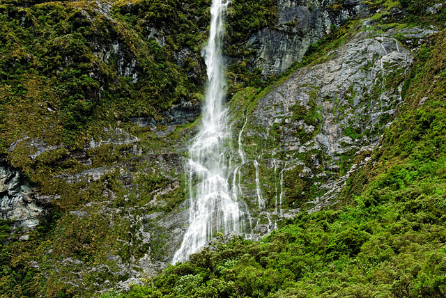
When we arrived to crossroads to Quintin Hut, Peter continued straight to our Dumpling Hut. But Zuzka's knees would need to hurt much more to skip visit to Sutherland Falls - the highest waterfalls in New Zealand (580m). I accompanied her. There is a public shelter near Quintin Hut with hot water. We made a tea and had short snack there.
It is about 45 minutes to Sutherland Falls from here, but many in our group got there in 30 min. All people we met on our way there were grinning, we were not sure why. Then one told us we are going to get completely wet there. The air got started to be wet when we got to 580m from the falls (there is a label there saying we are in distance equal to its height - nice touch to imagine better how tall it is). I changed to raincoat, overtrousers and gaiters again (the 3rd time today). Wetness of the air increased since then and when I stepped out from forest and stood in front of Sutherland Falls, in strong wet wind I took 2 photos and hid my camera under raincoat. I am not much concerned with raining on camera, but this was too much. On our way back to public shelter near Quintin Hut we were grinning like fools. This was the most impressive shower we ever got. The last 1 hour from Quintin Hut to Dumpling Hut took us 1.5h, we were definitely last people arriving, luckily before search and rescue action started :-)
Sutherland Falls.
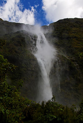
and from distance.
Day four
During briefing yesterday we've learned local Keas are smarter and they worked out how to destroy hanging things. As the first step they pull a thing from a peg and then continue with well known techniques as if it was always lying on the floor. We were asked to put everything inside of huts.
We woke up early in the morning. While going to nearby toilet we were eyed with angry Keas pacing nervously on the veranda, because they did not find anything to play with. They hated us for that and I imagine they knew it was the ranger who told us :-) We left at 7am, because our boat from Sandfly Point to Milford Sound was due at 2pm. It was 18km, mostly on flat path, with some descending and occasional short uphill sections. It was raining whole day, more after we arrived to Milford Sound Lodge. We have seen many beautiful waterfalls along the way. Unfortunately I could not take any photos, due to dead batteries. Since then I tried to take better care of them.Back