
| « Wellington | Geothermal wonders of Taupo and Rotorua » |
Tongariro Crossing in the rain
Added: May 22, 2010
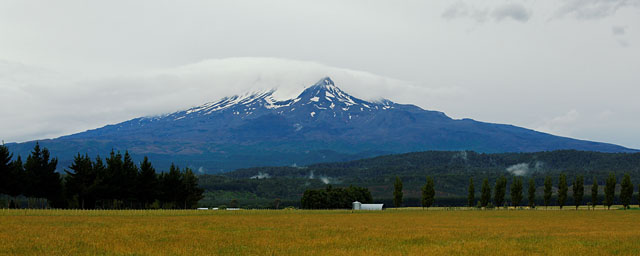
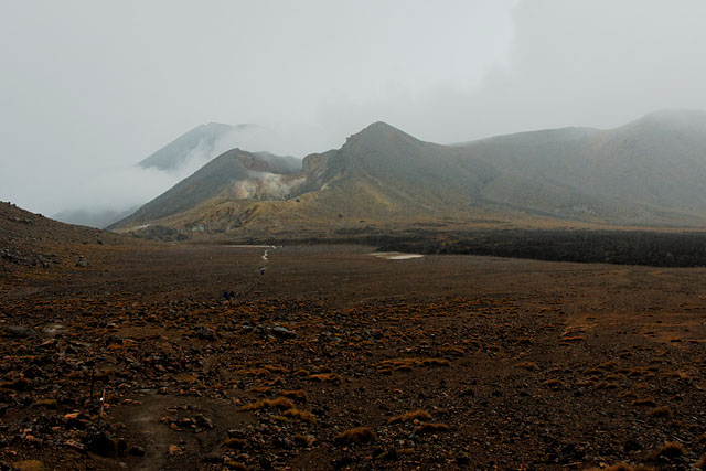
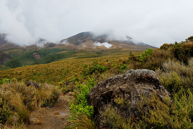
Mt Ruapehu
A bus collecting hikers going to Tongariro Crossing from local accommodations arrived at 7:45 and it slowly filled with hikers to last seat. We arrived to Mangatepopo car park. It was slightly drizzling. Temperature also did not remind summer.
Whole walk takes several hour, our bus at the end of trek leaves at 16:40. We should have plenty of time to get there, but we don't know how steep whole trek is. Better not waste much time. Trek starts with not very steep climb. Everything is rainy-greyish colour. After some time volcanic material starts to show around until it is everywhere.
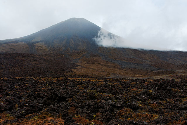
Clouds covering Mt Ngauruhoe.
Terrain is similar to Iceland.
Path starts to be steeper from Soda Springs. Rain stopped shortly, but heavy clouds were everywhere. Wind got stronger and it was also colder. The best thing we could do was to continue without many long stops. Just short stops for resting a bit.
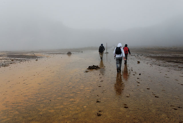
Then we started to climb to the South Crater of Mt Tongariro and we needed to rest more often. The South Crater is vast plane covered with a mud, at least when we were there. In order to make it worse it started to rain again and the mud started to stick to our shoes.
In South crater.
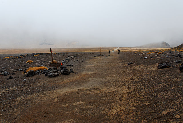
Rain in the South Crater of Mt Tongariro.
At the end of crater is steep, but short climb. It would be fantastic place to look around if the weather was better. But it was just grim sight due to heavy rain and low clouds.
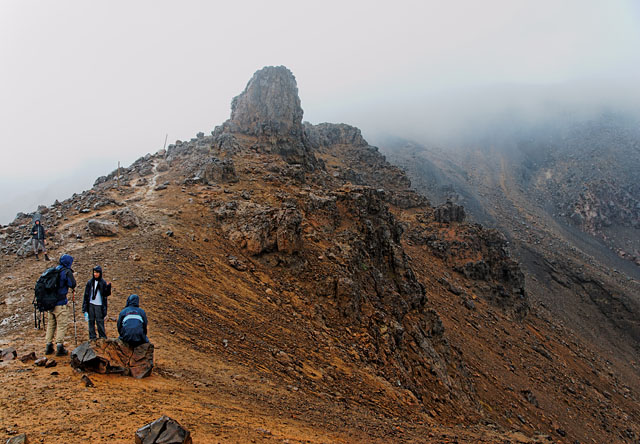
The Red Crater is the best part
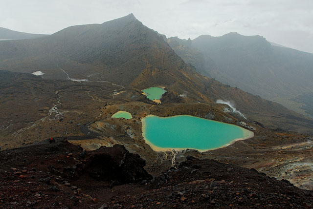
The last part of climbing is ahead of us. It is not far and we will see Red Crater and Emerald Lakes. They are wonderful and I wish we had better weather there.
When we descended to Emerald Lakes we could smell sulphur. This does not seem to be a good place for picnic, let's continue walking, we can eat later. We did not consider to climb to top of Mt Tongariro. Not in this weather.
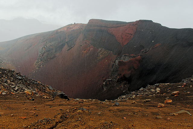
A view of Red Crater. Notice the rain.
Emerald Lakes. I was surprised with their colour. I knew they should be emerald, but in this rain I expected yellow mud..
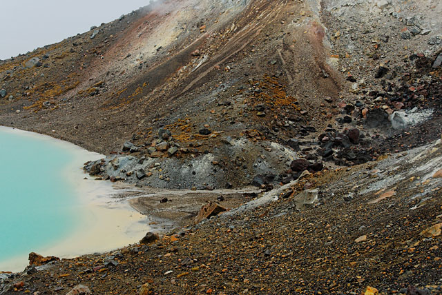
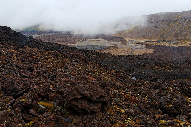
Amazing volcanic terrain.
A look back to Red Crater. The volcano you cannot see behind Red Crater is Mt Ngauruhoe. It is not a trick with camera, just weather.
I stayed behind a few hundred metres. A necessity to clean the lens before and after every photo (repeated 3 times) took some time. But nice place was behind us, with no possibility to offer any attractive photo due to rain filter so I could catch Zuzka and Peter up.
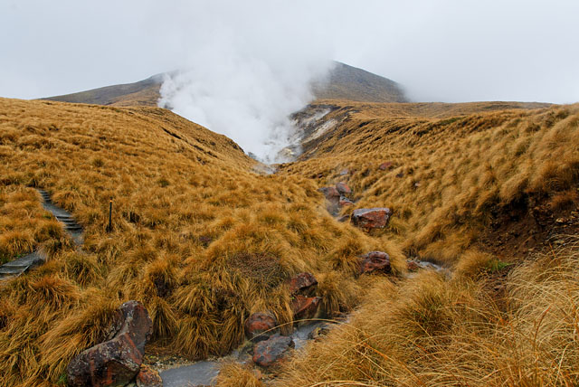
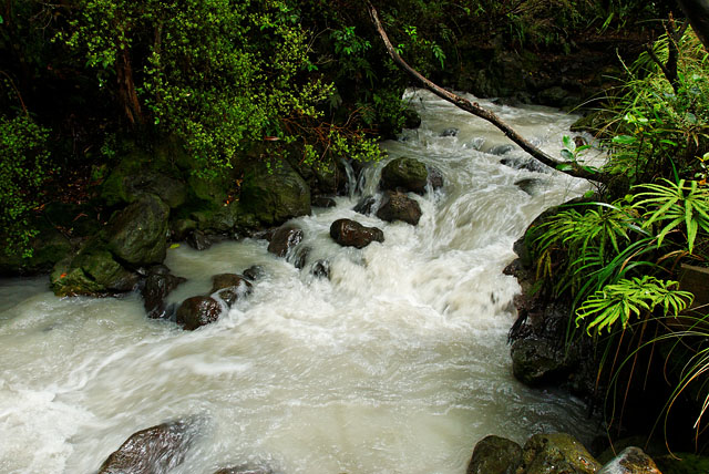
We started to descend to Ketetahi hut (with toilets!). It was much easier to go down all the time, it was not very steep, but sometimes the path got pretty slippery. Bellow the hut are hot springs, but they are private property and hikers are allowed only to use the path. So I just checked out water in the stream bellow the springs and it was nice. Not warm, but definitely it was not cold as you would expect from a stream. But it was white.
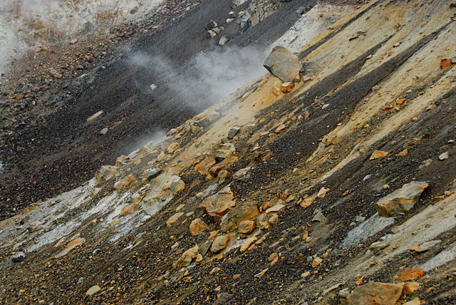
Steam shows the location of hot springs. It is not caused by weather, at least something.
We reached forest. It was still about 1.5h to go, but we could be sure we are going to catch our bus without any problems.
After arriving to parking lot Peter realized he left his camera at the hut. It was old one so there was no point to even think about going back... not to mention it can be used as a good excuse to buy new and better one :-)
I've mentioned a white water in the stream before. Here it is.
Conclusion
Whole trip took us only 6h and couple of minutes. I am sure we would spend there more time if weather was better. It was very good hike, but I feel like Tongariro Crossing does owe us something... (google for other images if you want to know what).
By the way, nothing attracted more traffic to my site than eruption of Eyjafjallajökull. Everybody was interested how Eyjafjallajökull looked before eruption. So, just a hint, because my photos of Tongariro are published now, maybe it is time for some of volcanoes here to create more traffic to this site :-)Back