| « Wanaka | Glacier from ground and from air » |
Amazing scenic drive to Franz Josef
Added: April 18, 2010
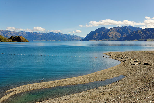
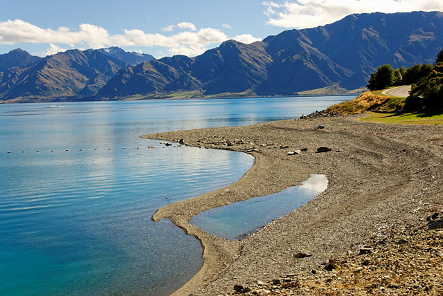
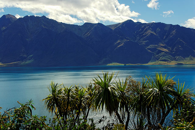
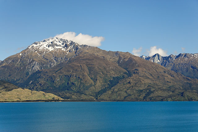
Lake Hawea
Our first and unpredicted stop was at Lake Hawea. We missed it during our planning, because it did not look like much on a map. But we could not miss it while passing around :-)
Lake Hawea is big and it is quite close to Wanaka. We could see it from Mt Iron yesterday, but we would not imagine it will yield so nice photos today. We stopped couple of times along its shore and the view was always different. Plus there are plenty of geocaches for people who cannot live without searching them. Disadvantage of being here in morning was that some mountains were against the sun. If we were here in the evening we would get better photos.
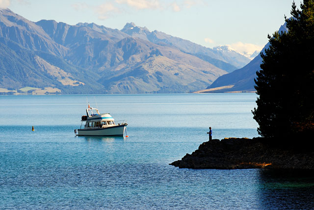
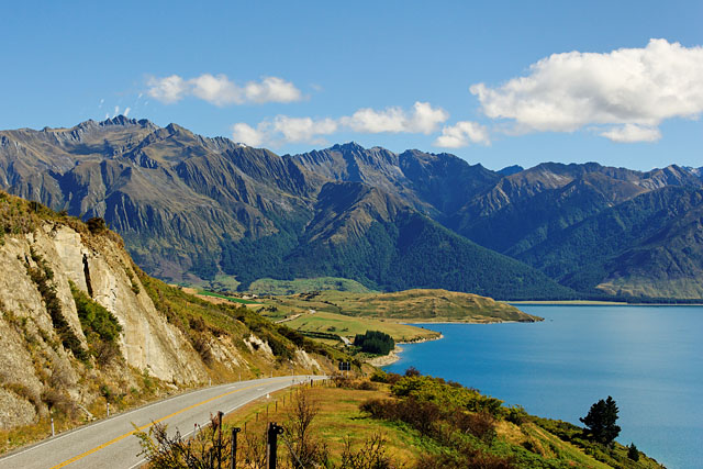
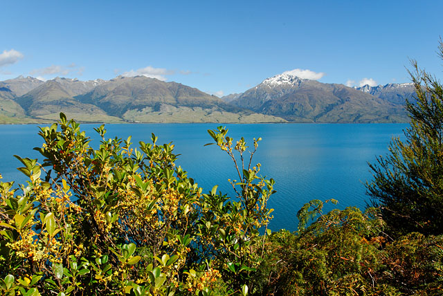
Lake Wanaka
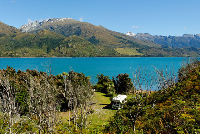
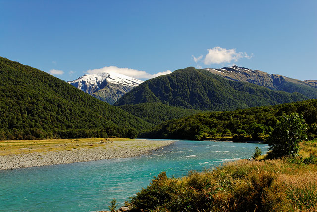
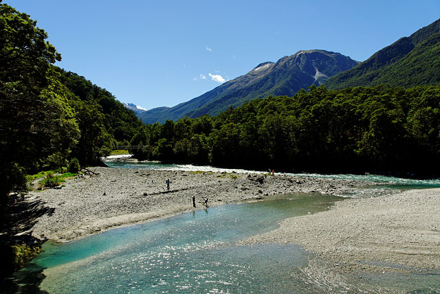
And again we were near Lake Wanaka. Wanaka was left far behind, but Lake Wanaka is even bigger than Lake Hawea and curved so we came to it again. Am I starting to be confusing? Don't worry, it is not important. Important point is that it is beautiful and worth of stopping to enjoy the view or to take couple of photos. Or maybe to park your campervan if you are not in hurry like us.
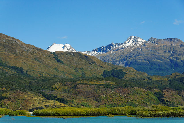
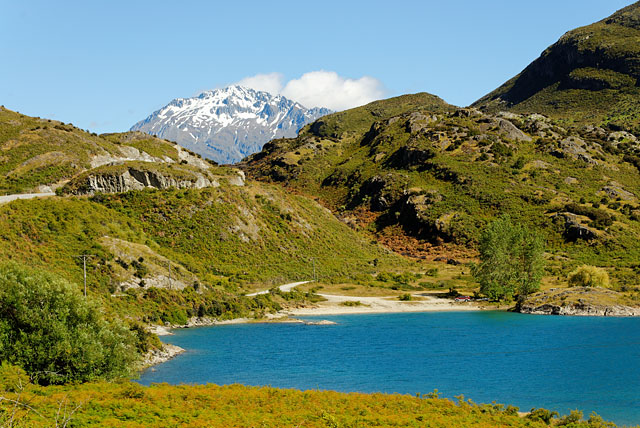
This is not Lake Wanaka any more, but this river feeds it. Photo was taken about 10 minutes later.
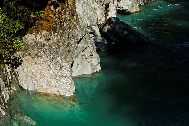
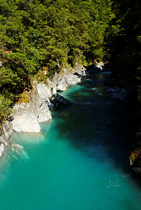
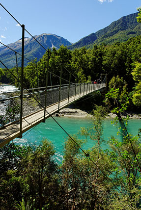
Blue Pools
We found some photos of Blue Pools during our planning and wanted to stop here, but we were not sure if we will be able to find the place. But our doubts were unfounded - it is not possible to miss it. There is parking lot directly at road 6 and big billboard.
Then you need to walk for about 20minutes through rain forest, but it was rather dry when we were there. Sebastian we met at Milford Track told us they were here when it was raining (about a week ago) and the blue pools were muddy. But not today - they were clean and blue.
Thunder Creek Falls
After visiting Blue Pools we continued driving through Haast Pass. It is curvy road between small hills. At one longer descent we started to smell burning so we stopped at nearby parking lot and found there is a waterfall a few metres ahead. We left the car to cool down and went to explore the waterfall we found only by chance.
This is a crop from panorama. I don't think vertical panorama would look well here so I cropped it. But if you want to see more click here.

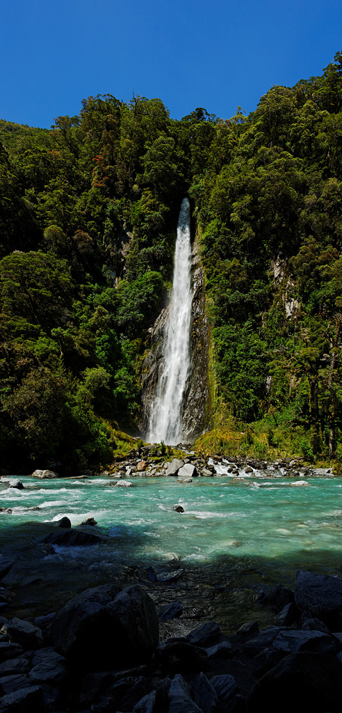
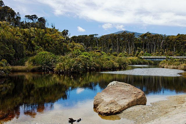
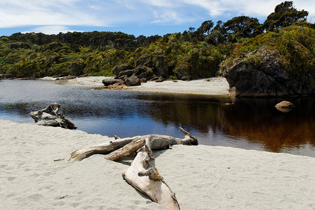
Ship Creek
More and more rainforest foliage started to show around us. The country slowly flattened until we could see Tasman Sea ahead of us. At that time we were driving through marshland with only occasional tree. I liked hilly region more.
We were slowly running out of gas. Since Wanaka we did not see any petrol station so we hoped to find one in Haast. But we went through the town and nothing. Only after we went further to coast we found it. From Haast we were going along western shore of south island. We stopped at Ship Creek (toilets!) and found it is not bad place for taking photographs at all. The name of this place has interesting history. A shipwreck from coast of Australia drifted in Tasman Sea until it was beached here. (What a big deal - it takes 3 hours by plane to overcome Tasman Sea ;-) )
Lake Matheson
We returned to Lake Matheson from Franz Josef in the evening, but technically it is along the road to Franz Josef. So I am going to show it first.
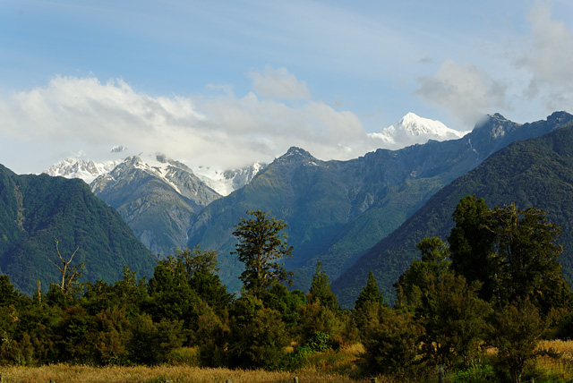
Lake Matheson is another Must in New Zealand - it is featured on many postcards, mirroring Mt Cook in its water. But the clouds thickened enough to obscure Mt Cook completely. We waited for long time and we either could see a glimpse of Mt Tasman or Mt Cook. But the water was not still at that moment. And when the water was still, clouds were in place. Or the sun hid behind the thick layer of clouds and we were finished. Eventually we got good view of Mt Cook, but at that time we were in local restaurant. Well, time passes quicker when you have nice pizza on your table.
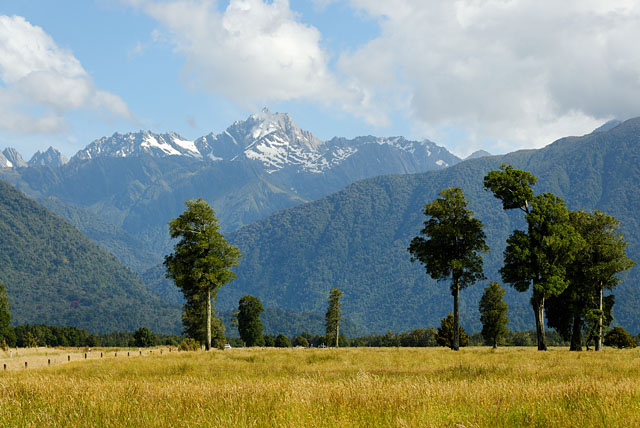
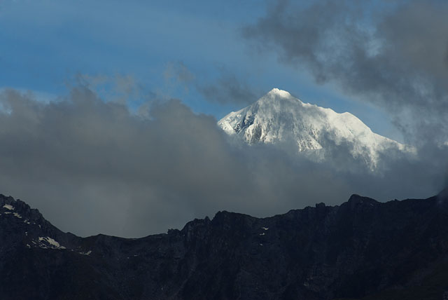
I failed to learn the name of that mountain. I have checked Google, Google Earth, Lonely Planet and the map. But the name is still unknown to me. So if you know what it is, I would be very glad if you wrote me a comment. Thank you. It was taken near restaurant at Lake Matheson.
Still water => no mountains
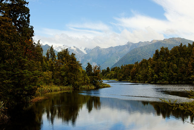
Mt Cook peeking => no reflection
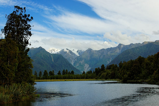
Mt Cook peeked out from clouds!
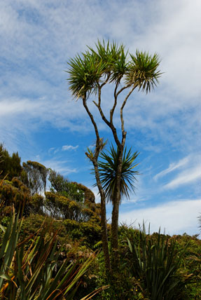
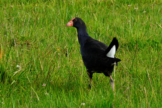
Local life form.
Mt Cook as you can see it from local restaurant.
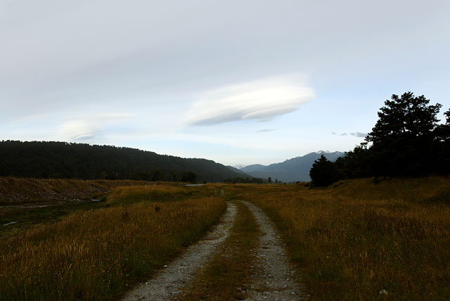
A proper way to end a day is to look for another geocache. It helps if some is nearby. And you can bet there are some in this area.
Just couple of kilometres to the west along Cook Flat Rd and we were there. It was rather dark, even sun did not set yet, but it was behind thick layer of clouds.
Fox Glacier.
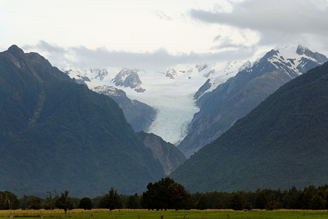
While Peter searched place to get his two hundred something-th geocache I was watching suspicious clouds to make sure no extraterrestrial gets behind our backs.